EditorialCreativeSportKollektionenVideos
Preise
0Anmelden

Visuelle Inhalte für Profis.
800 Mio.+ Bilder und Videos.

Content-Hub

  • Aktuelle Ereignisse
  • Bilder des Jahres
  • Sport
  • Editorial
  • Creative
  • Kollektionen
  • Videos

Angebote

  • Preise & Pakete
  • Aktionen
  • Enterprise
  • Newsletter
  • Blog
  • The Game Magazine

Services

  • Bildrecherche
  • Auftragsfotografie
  • API & FTP Push
  • my-picturemaxx
  • Partner werden

Unternehmen

  • Über IMAGO
  • Karriere
  • News

Hilfe-Center

  • FAQ
  • Kontakt
ImpressumNutzungsbedingungenLizenzinformationenDatenschutzDatenschutzeinstellungen
© 2026 IMAGO
CEPICBAPLABVPA
  1. USA, Hurrikan Barry über dem Golf von Mexiko - Satellitenbilder

USA, Hurrikan Barry über dem Golf von Mexiko - Satellitenbilder

13.07.2019

Die folgenden Fotos wurden von der IMAGO Bildredaktion zu diesem Thema für Sie ausgewählt. Für weitere Bilder nutzen Sie bitte die Suchfunktion.
Bilder in dieser Kollektion

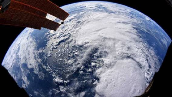
  • July 13, 2019, Earth Atmosphere: Hurricane Barry is a currently active tropical cyclone that has made landfall in the state of Louisiana and is currently threatening the Gulf Coast of the United States. Originating from a mesoscale convective vortex over the Midwestern United States, the system emerged into the Gulf of Mexico on JulyÊ10 and was classified as a potential tropical cyclone later that day. The system developed into a tropical storm on the next day, becoming the second named storm of the annual hurricane season. On July 13, Barry achieved a sustained wind speed of 75 mph (120 km h), becoming the first hurricane of the 2019 season. PICTURED: July 11th. Earth Atmosphere - ZUMAz03_ 20190713_sha_z03_631 Copyright: xNASAx

    July 13, 2019, Earth Atmosphere: Hurricane Barry is a currently active tropical cyclone that has made landfall in the state of Louisiana and is currently threatening the Gulf Coast of the United States. Originating from a mesoscale convective vortex over the Midwestern United States, the system emerged into the Gulf of Mexico on JulyÊ10 and was classified as a potential tropical cyclone later that day. The system developed into a tropical storm on the next day, becoming the second named storm of the annual hurricane season. On July 13, Barry achieved a sustained wind speed of 75 mph (120 km h), becoming the first hurricane of the 2019 season. PICTURED: July 11th. Earth Atmosphere - ZUMAz03_ 20190713_sha_z03_631 Copyright: xNASAx

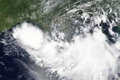
  • The Moderate Resolution Imaging Spectroradiometer (MODIS) onboard NASA s Terra satellite acquired a true-color image of Tropical Storm Barry approaching the Gulf Coast on July 11, 2019. Barry has since increased in intensity and become the first hurricane of the 2019 Atlantic hurricane season. NASA  WAX2019071302 NASA

    The Moderate Resolution Imaging Spectroradiometer (MODIS) onboard NASA s Terra satellite acquired a true-color image of Tropical Storm Barry approaching the Gulf Coast on July 11, 2019. Barry has since increased in intensity and become the first hurricane of the 2019 Atlantic hurricane season. NASA WAX2019071302 NASA

Kollektionen