EditorialCreativeSportKollektionenVideos
Preise
0Anmelden

Visuelle Inhalte für Profis.
800 Mio.+ Bilder und Videos.

Content-Hub

  • Aktuelle Ereignisse
  • Bilder des Jahres
  • Sport
  • Editorial
  • Creative
  • Kollektionen
  • Videos

Angebote

  • Preise & Pakete
  • Aktionen
  • Enterprise
  • Newsletter
  • Blog
  • The Game Magazine

Services

  • Bildrecherche
  • Auftragsfotografie
  • API & FTP Push
  • my-picturemaxx
  • Partner werden

Unternehmen

  • Über IMAGO
  • Karriere
  • News

Hilfe-Center

  • FAQ
  • Kontakt
ImpressumNutzungsbedingungenLizenzinformationenDatenschutzDatenschutzeinstellungen
© 2026 IMAGO
CEPICBAPLABVPA
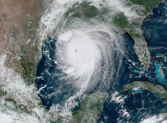
  1. USA, Satellitenbild von Hurrikan Laura über dem Golf von Mexiko

USA, Satellitenbild von Hurrikan Laura über dem Golf von Mexiko

26.08.2020

Die folgenden Fotos wurden von der IMAGO Bildredaktion zu diesem Thema für Sie ausgewählt. Für weitere Bilder nutzen Sie bitte die Suchfunktion.
Bilder in dieser Kollektion

  • August 26, 2020, Gulf of Mexico, USA: Satellite image shows Hurricane Laura in the Gulf of Mexico. Laura is forecast to make landfall along the Gulf Coast as a Category 4 storm. As of Wednesday morning, Laura is a Category 3 storm with maximum sustained winds of at least 115 mph. Forecasters predict a storm surge from 9 to 14 feet when it strikes near the Louisiana Texas border. Gulf of Mexico USA - ZUMAz03_ 20200826_zan_z03_745 Copyright: xNOAAx

    August 26, 2020, Gulf of Mexico, USA: Satellite image shows Hurricane Laura in the Gulf of Mexico. Laura is forecast to make landfall along the Gulf Coast as a Category 4 storm. As of Wednesday morning, Laura is a Category 3 storm with maximum sustained winds of at least 115 mph. Forecasters predict a storm surge from 9 to 14 feet when it strikes near the Louisiana Texas border. Gulf of Mexico USA - ZUMAz03_ 20200826_zan_z03_745 Copyright: xNOAAx

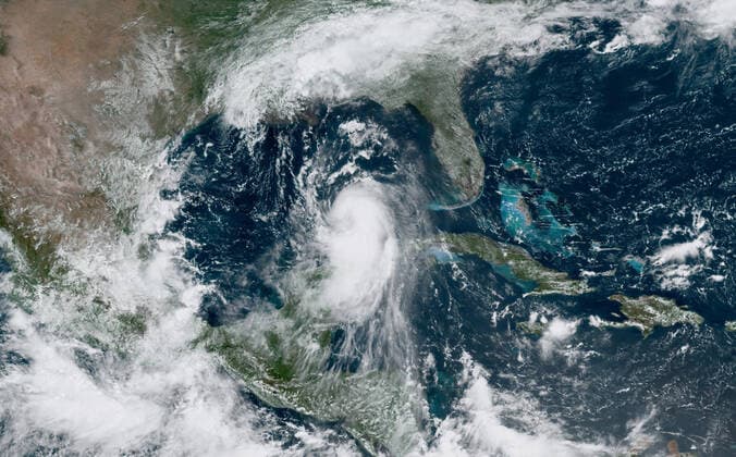
  • August 25, 2020, Gulf of Mexico, USA: Satellite image shows Hurricane Laura in the Gulf of Mexico early Tuesday morning. Laura is forecast to make landfall along the Gulf Coast as a Category 4 storm. As of Wednesday morning, Laura is a Category 3 storm with maximum sustained winds of at least 115 mph. Forecasters predict a storm surge from 9 to 14 feet when it strikes near the Louisiana Texas border. Gulf of Mexico USA - ZUMAz03_ 20200826_zan_z03_743 Copyright: xNOAAx

    August 25, 2020, Gulf of Mexico, USA: Satellite image shows Hurricane Laura in the Gulf of Mexico early Tuesday morning. Laura is forecast to make landfall along the Gulf Coast as a Category 4 storm. As of Wednesday morning, Laura is a Category 3 storm with maximum sustained winds of at least 115 mph. Forecasters predict a storm surge from 9 to 14 feet when it strikes near the Louisiana Texas border. Gulf of Mexico USA - ZUMAz03_ 20200826_zan_z03_743 Copyright: xNOAAx

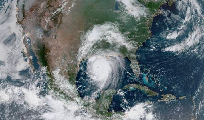
  • August 26, 2020, Gulf of Mexico, USA: Satellite image shows Hurricane Laura in the Gulf of Mexico. Laura is forecast to make landfall along the Gulf Coast as a Category 4 storm. As of Wednesday morning, Laura is a Category 3 storm with maximum sustained winds of at least 115 mph. Forecasters predict a storm surge from 9 to 14 feet when it strikes near the Louisiana Texas border. Gulf of Mexico USA - ZUMAz03_ 20200826_zan_z03_744 Copyright: xNOAAx

    August 26, 2020, Gulf of Mexico, USA: Satellite image shows Hurricane Laura in the Gulf of Mexico. Laura is forecast to make landfall along the Gulf Coast as a Category 4 storm. As of Wednesday morning, Laura is a Category 3 storm with maximum sustained winds of at least 115 mph. Forecasters predict a storm surge from 9 to 14 feet when it strikes near the Louisiana Texas border. Gulf of Mexico USA - ZUMAz03_ 20200826_zan_z03_744 Copyright: xNOAAx

Kollektionen