EditorialCreativeSportKollektionenVideos
Preise
0Anmelden

Visuelle Inhalte für Profis.
800 Mio.+ Bilder und Videos.

Content-Hub

  • Aktuelle Ereignisse
  • Bilder des Jahres
  • Sport
  • Editorial
  • Creative
  • Kollektionen
  • Videos

Angebote

  • Preise & Pakete
  • Aktionen
  • Enterprise
  • Newsletter
  • Blog
  • The Game Magazine

Services

  • Bildrecherche
  • Auftragsfotografie
  • API & FTP Push
  • my-picturemaxx
  • Partner werden

Unternehmen

  • Über IMAGO
  • Karriere
  • News

Hilfe-Center

  • FAQ
  • Kontakt
ImpressumNutzungsbedingungenLizenzinformationenDatenschutzDatenschutzeinstellungen
© 2026 IMAGO
CEPICBAPLABVPA
Zurück zu den Kollektionen

IMAGO History, Nahostkonflikt, Chronik, UN-Teilungsplan für Palästina 1947

29.04.2024

Die folgenden Fotos wurden von der IMAGO Bildredaktion zu diesem Thema für Sie ausgewählt. Für weitere Bilder nutzen Sie bitte die Suchfunktion.
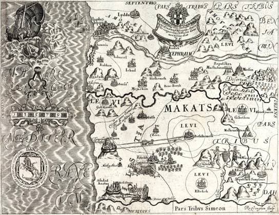
  • Israel Palestine: Map depicting the Tribe of Dan, from a later edition of Thomas Fuller s (1608-1661) A Pisgah-sight of Palestine, 1869 Thomas Fuller (1608-1661) was an English churchman, historian and writer. Born in Aldwinker St Peter s, Northamptonshire, his father was rector of the community. He was admitted to Queens College in Cambridge and did well academically. Fuller was a prolific author, one of the first English writers to live by his pen. He is particularly remembered for his Worthies of England, published in 1662 after his death. Copyright: xThomasxFullerx(1608-1661)xPicturesxFromxHistoryx
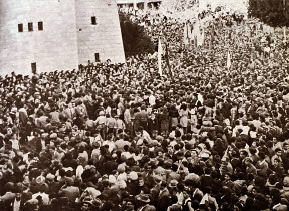
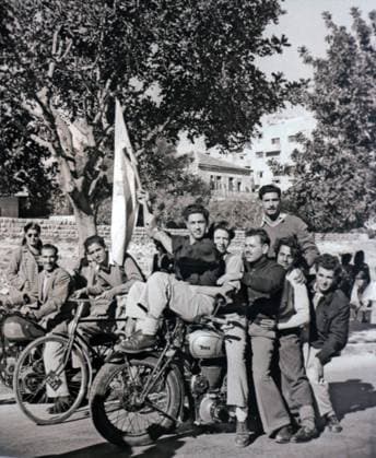
  • Jews in Jerusalem waving a flag, express joy, after the Partition Plan on November 29, 1947. The United Nations Partition Plan for Palestine was a proposal by the United Nations, which recommended a partition of Mandatory Palestine at the end of the British Mandate. On 29 November 1947, the UN General Assembly adopted the Plan as Resolution 181, Copyright: xUnitedxArchivesx xWorldxHistoryxArchivex WHA_119_0731 EDITORIAL USE ONLY
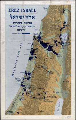
  • RECORD DATE NOT STATED Erez Israel - Erets Yiśraʼel : adamah Ê»Ivrit , Palestine, Maps, Palestine, History, 1917-1948, Sources, Jews, History, 20th century, Zionism, History Norman B. Leventhal Map Center Collection Copyright: xpiemagsx digcompie09122022-48419 !ACHTUNG AUFNAHMEDATUM GESCHÄTZT!
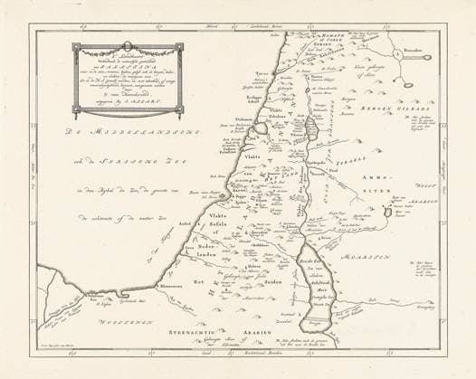
  • Map of Palestine; IE map Distributing the natural state of Palestine where in the seas, rivers, blanket (...). Copyright: xpiemagsx rykslarge07062021part3-8900 !ACHTUNG AUFNAHMEDATUM GESCHÄTZT!
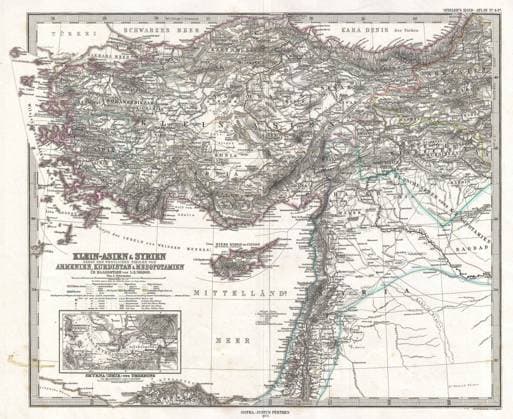
  • 1873 Stieler Map of Asia Minor, Syria and Israel - Palestine (modern Turkey) Copyright: xpiemagsx piegeogr230322-1934 !ACHTUNG AUFNAHMEDATUM GESCHÄTZT!
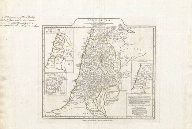
  • 1794 Anville Map of Israel, Palestine or the Holy Land in Ancient Times Copyright: xpiemagsx piegeogr230322-485 !ACHTUNG AUFNAHMEDATUM GESCHÄTZT!
  • Map of ancient Syria published in 1900. The boundaries of Syria are shown to include Palestine as far as Gaza, all of Lebanon, and Antakya in Turkey. This corresponds quite closely to Syria before the French Mandate was imposed in 1920. Lebanon was separated from Syria by the French in 1926, and Turkey occupied Antakya unilaterally in 1939. Supplier:xCPAxMediaxCo.xLtd. 1060_05_CPA0008827
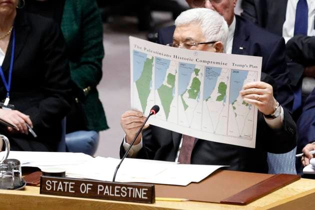
  • (200211) -- UNITED NATIONS, Feb. 11, 2020 -- Palestinian President Mahmoud Abbas (Front) holds a map as he addresses a UN Security Council meeting on the situation in the Middle East, including the Palestinian question, at the UN headquarters in New York, on Feb. 11, 2020. Palestinian President Mahmoud Abbas on Tuesday reiterated the rejection of a newly released U.S. Middle East peace plan, calling it an Israeli-American proposal. ) UN-SECURITY COUNCIL-MIDDLE EAST LixMuzi
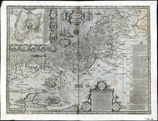
  • CANAAN XVIIeme s. Carte de la region du Canaan datant de 1611 (17eme, 17e, XVIIeme s.) Credit : Collection British Library KHARBINE-TAPABOR. *** CANAAN XVIIth s Map of the Canaan region dating from 1611 17th, 17th, XVIIth s Credit Collection British Library KHARBINE TAPABOR  KH409196
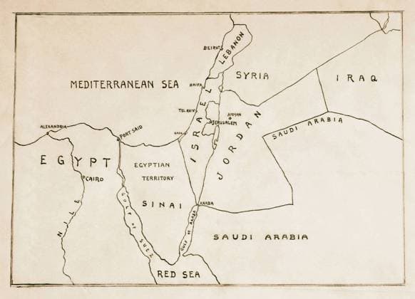
  • Palestine & Israel subjects of 1953. Near East, map as in 1953 (flat) showing Israel . 1953  Copyright: LisztxCollection LCME180713_10636
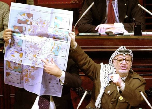
  • BRU28 - - BRUSSELS, BELGIUM : (FILES) A picture dated Thursday 31 May 2001 shows President of the Palestinian Authority Yasser Arafat using a map of Palestina to illustrate his speech at the Belgian Senate in Brussels. Teams of doctors from Jordan and other Arab states have been summoned to Ramallah to examine Palestinian Authority President Yasser Arafat whose health dramatically deteriorated over the past several days, reports said Thursday 28 October 2004. The 75-year-old Palestinian President was in unstable condition, a senior Palestinian official who spent the night with the ailing Palestinian president said in remarks reported Thursday morning. The unnamed official, quoted by Israel¿s Itim newsagency, said Arafat has been unable to eat or drink properly since Wednesday afternoon. Arafat¿s wife, Suha, was expected to arrive in Ra  x2329760x
  • Photograph of a crowd of Palestinian Jews gather in Jerusalem to await the result of the United Nations vote on partition for Palestine, 29 November 1947. Dated 20th Century WorldxHistoryxArchive 917_05_WHA_101_0126
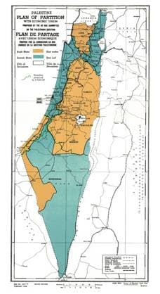
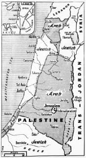
  • partition plan for Palestine issued by the United Nations 1947 WHA  !ACHTUNG AUFNAHMEDATUM GESCHÄTZT! Copyright: WHA UnitedArchivesWHA_036_0973
  • United Nations plan for the partition of Palestine at the end of the British Mandate. Shows areas designated for Jews and Palestinian Arabs 1947 WHA  !ACHTUNG AUFNAHMEDATUM GESCHÄTZT! Copyright: WHA UnitedArchivesWHA_049_0127
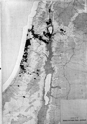
  • Map. Extent of Jewish land holdings in Palestine; issued by the Jewish National Fund Jerusalem WHA  !ACHTUNG AUFNAHMEDATUM GESCHÄTZT! Copyright: WHA UnitedArchivesWHA_046_0526
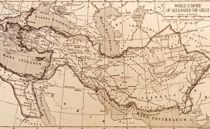
  • Map showing the empire of the Greek conqueror, Alexander the Great 356-323 BC WorldxHistoryxArchive
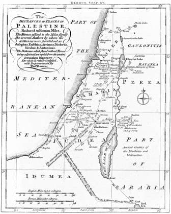
  • Map of Palestine showing distances in Roman miles. Based on various ancient authors and the Jerusalem Itinerary . Engraving c1830. WHA  !ACHTUNG AUFNAHMEDATUM GESCHÄTZT! Copyright: WHA UnitedArchives0390000153
  • Palestine: September 1, 1947 A map showing the shaded areas of the Arab State recommended by U.N. Special Committee on Palestine. The unshaded areas are the Jewish State. Jerusalem and its environs, including Bethlehem, would be internationalized under a United Nations trusteeship. xUnderwoodxArchives 1-Sci-Cart_1
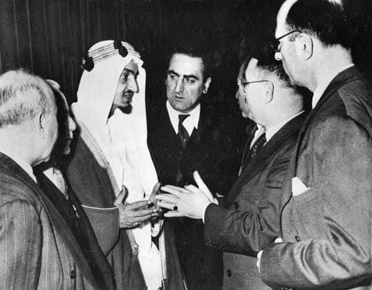
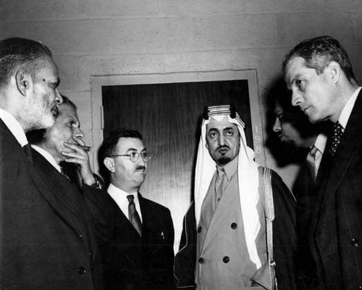
  • Prince Amir Faisal al Saud, Saudi Arabian delegate to the United Nations, seen with members of various delegations at Flushing, following meeting which discussed the right of Jews to be represented at the special session to consider the Palestine problem. 3rd May 1947, Vereinte Nationen, UN UnitedArchives00583273
  • Members of the Arab countries represented at the United Nations gathered in the lobby at Flushing Medows where the General Assembly was discussing the plan for the partition of Palestine. from left: Zafrullah Khan of Pakistan, Jamal Husseini of Arqb Higher Committee, Fadhil Jamali of Iraq, Faisal al Saud of Saudi Arabia, Ali Alireza of Saudi Arabia and Camille Chamoun of Lebanon 3rd December 1947, Vereinte Nationen, UN UnitedArchives00583269
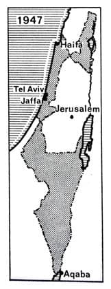
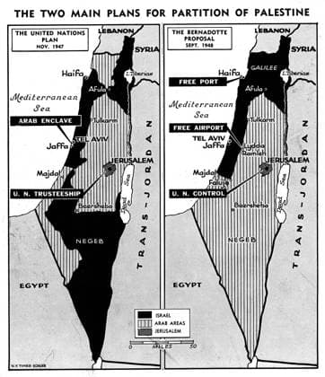
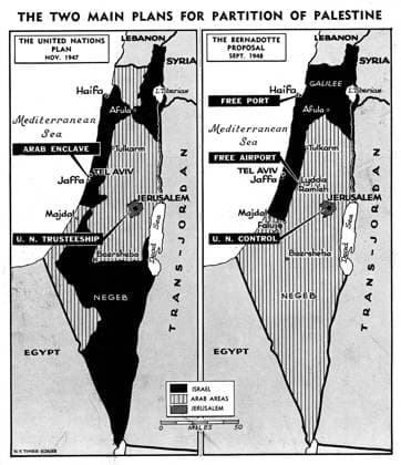
  • Maps showing the two main plans for partition of Palestine - United Nations Plan November 1947 and Bernadotte Proposal September 1948, Vereinte Nationen, UN UnitedArchives00415624
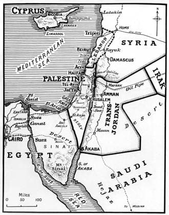
  • A map of the affected area in the Middle East situation 12th January 1949 UnitedArchives00415617
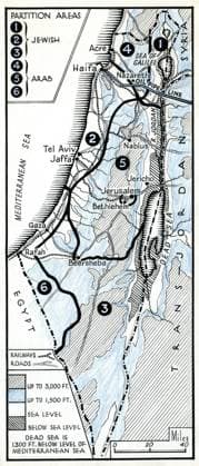
  • Map of Partition areas of Palestine . 1947 UnitedArchives00415616
  • Maps showing the two main plans for partition of Palestine - United Nations Plan November 1947 and Bernadotte Proposal September 1948 Mono Print UnitedArchives1244610
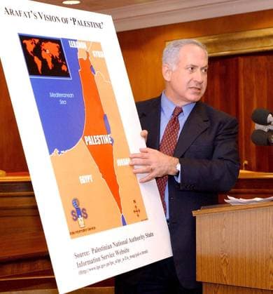
  • Benjamin Netanyahu (ISR Vorsitzender LIKUD) warnt vor der Herrschaft der Palästinenser und dem damit verbundenen Verschwinden Israels von der Landkarte in Washington D.C. -  (WAP2002041002)