EditorialCreativeSportKollektionenVideos
Preise
Anmelden

Visuelle Inhalte für Profis.
800 Mio.+ Bilder und Videos.

Content-Hub

  • Aktuelle Ereignisse
  • Bilder des Jahres
  • Sport
  • Editorial
  • Creative
  • Kollektionen
  • Videos

Angebote

  • Preise & Pakete
  • Aktionen
  • Enterprise
  • Newsletter
  • Blog
  • The Game Magazine

Services

  • Bildrecherche
  • Auftragsfotografie
  • API & FTP Push
  • my-picturemaxx
  • Partner werden

Unternehmen

  • Über IMAGO
  • Karriere
  • News

Hilfe-Center

  • FAQ
  • Kontakt
ImpressumNutzungsbedingungenLizenzinformationenDatenschutz
© 2026 IMAGO
CEPICBAPLABVPA
  1. IMAGO, Archiv, USA, Eisenbahnkarten 1860–1900

IMAGO, Archiv, USA, Eisenbahnkarten 1860–1900

22.09.2026

Die folgenden Fotos wurden von der IMAGO Bildredaktion zu diesem Thema für Sie ausgewählt. Für weitere Bilder nutzen Sie bitte die Suchfunktion.
Bilder in dieser Kollektion

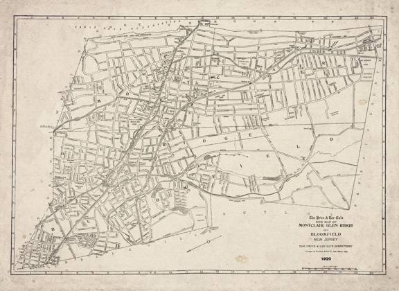
  • Historische Karte von Montclair New Jersey, Montclair, Glen Ridge und Bloomfield, 1920, digital überarbeitet und verbessert Montclair New Jersey Historic Map, Montclair, Glen Ridge and Bloomfield, 1920, Digitally Remastered and Enhanced Copyright: imageBROKER Allexxandar ibxavu18902588.jpg

    Historische Karte von Montclair New Jersey, Montclair, Glen Ridge und Bloomfield, 1920, digital überarbeitet und verbessert Montclair New Jersey Historic Map, Montclair, Glen Ridge and Bloomfield, 1920, Digitally Remastered and Enhanced Copyright: imageBROKER Allexxandar ibxavu18902588.jpg

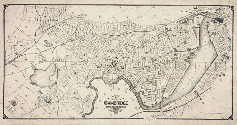
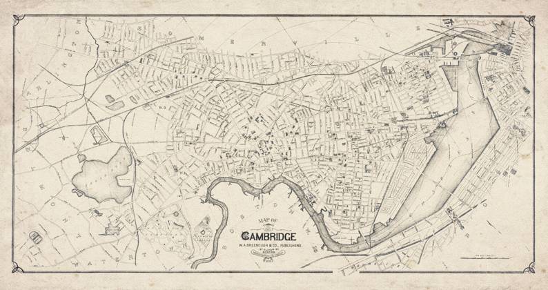
  • Historische Karte von Cambridge, Massachusetts, Stadtplan von 1894, digital überarbeitet und verbessert Historic Map of Cambridge, Massachusetts, City Map from 1894, Digitally Remastered and Enhanced Copyright: imageBROKER Allexxandar ibxavu18902566.jpg

    Historische Karte von Cambridge, Massachusetts, Stadtplan von 1894, digital überarbeitet und verbessert Historic Map of Cambridge, Massachusetts, City Map from 1894, Digitally Remastered and Enhanced Copyright: imageBROKER Allexxandar ibxavu18902566.jpg

  • Historische Straßen und topographische Karte von Cambridge, Massachusetts, 1894, digital überarbeitet und verbessert Historic Street and Topographic Map of Cambridge, Massachusetts, 1894, Digitally Remastered and Enhanced Copyright: imageBROKER Allexxandar ibxavu18902564.jpg

    Historische Straßen und topographische Karte von Cambridge, Massachusetts, 1894, digital überarbeitet und verbessert Historic Street and Topographic Map of Cambridge, Massachusetts, 1894, Digitally Remastered and Enhanced Copyright: imageBROKER Allexxandar ibxavu18902564.jpg

  • Map Railroad Routes 1960s, A map showing the southeastern railroad routes of the 1960s when there were still some passenger routes running.

    Map Railroad Routes 1960s, A map showing the southeastern railroad routes of the 1960s when there were still some passenger routes running.

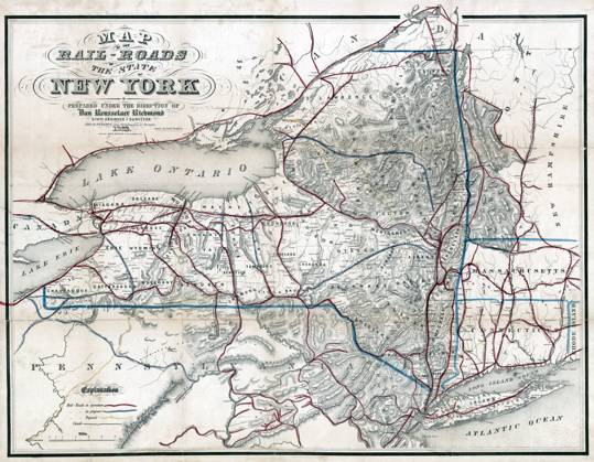
  • MAP: RAILROAD, 1862. Map of railroad routes for New York State. Lithograph, 1862.  Copyright: xGRANGERx xGRANGERx 0649730

    MAP: RAILROAD, 1862. Map of railroad routes for New York State. Lithograph, 1862. Copyright: xGRANGERx xGRANGERx 0649730

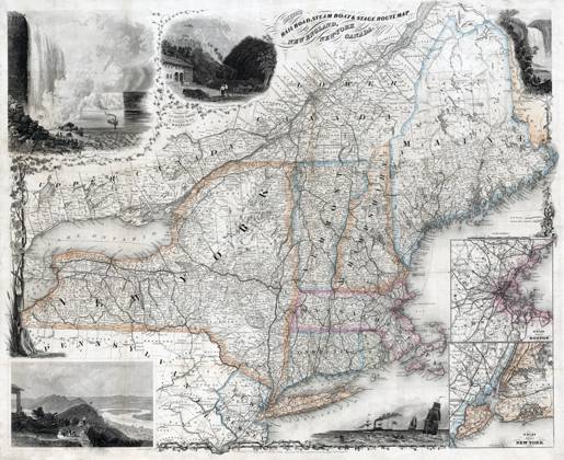
  • MAP: TRANSPORTATION ROUTE. Travel routes for railroad, steamboats and stagecoach through New England, New York, and Canada with inset maps 15 miles around Boston and New York. Line engraving by J.C. Smith, 1861.  Copyright: xGRANGERx xGRANGERx 0649729

    MAP: TRANSPORTATION ROUTE. Travel routes for railroad, steamboats and stagecoach through New England, New York, and Canada with inset maps 15 miles around Boston and New York. Line engraving by J.C. Smith, 1861. Copyright: xGRANGERx xGRANGERx 0649729

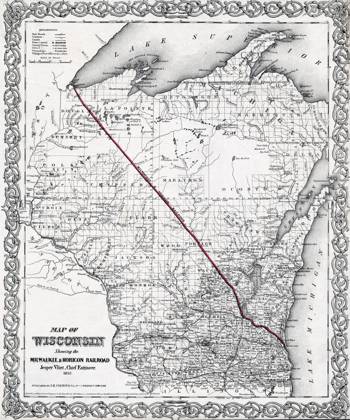
  • MAP: WISCONSIN, 1857. Map of Wisconsin showing the Milwaukee & Horicon Railroad. Hand colored drawing, 1857.  Copyright: xGRANGERx xGRANGERx 0649694

    MAP: WISCONSIN, 1857. Map of Wisconsin showing the Milwaukee & Horicon Railroad. Hand colored drawing, 1857. Copyright: xGRANGERx xGRANGERx 0649694

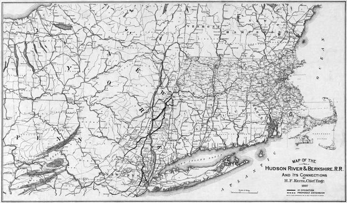
  • MAP: NEW ENGLAND, 1897. Map of the Hudson River & Bershire Railroad and its connections. Lithograph by Herbert F. Keith and Geo. H. Walker & Co., 1897.  Copyright: xGRANGERx xGRANGERx 0646402

    MAP: NEW ENGLAND, 1897. Map of the Hudson River & Bershire Railroad and its connections. Lithograph by Herbert F. Keith and Geo. H. Walker & Co., 1897. Copyright: xGRANGERx xGRANGERx 0646402

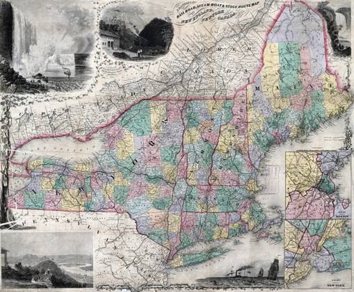
  • MAP: NEW ENGLAND, 1863. E.P. Dutton & Co. s railroad, steam boat, and stage route map of New England, New York, and Canada. Engraving by John Calvin Smith, 1863.  Copyright: xGRANGERx xGRANGERx 0646401

    MAP: NEW ENGLAND, 1863. E.P. Dutton & Co. s railroad, steam boat, and stage route map of New England, New York, and Canada. Engraving by John Calvin Smith, 1863. Copyright: xGRANGERx xGRANGERx 0646401

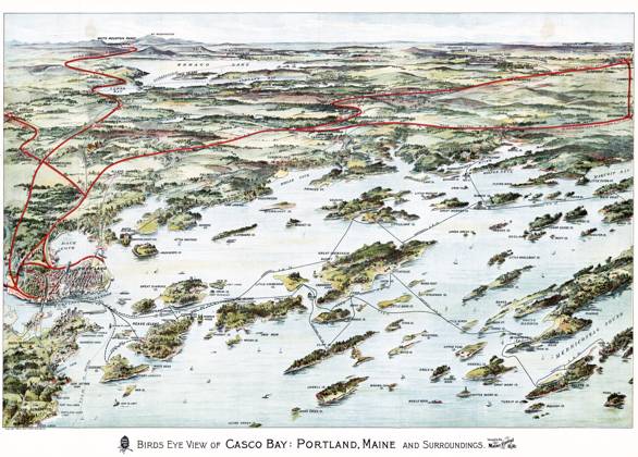
  • MAP: CASCO BAY, c1906. An aerial depiction of Casco Bay and Portland, Maine, with railroad and ferry routes marked. Pictorial map produced for the Maine Central Railroad Company, c1906.  Copyright: xGRANGERx xGRANGERx 0621244

    MAP: CASCO BAY, c1906. An aerial depiction of Casco Bay and Portland, Maine, with railroad and ferry routes marked. Pictorial map produced for the Maine Central Railroad Company, c1906. Copyright: xGRANGERx xGRANGERx 0621244

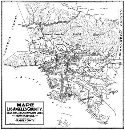
  • MAP: LOS ANGELES, 1912. Map of Los Angeles, showing the steam and electric railway lines in Orange County. Lithograph, 1912.  Copyright: xGRANGERx xGRANGERx 0527754

    MAP: LOS ANGELES, 1912. Map of Los Angeles, showing the steam and electric railway lines in Orange County. Lithograph, 1912. Copyright: xGRANGERx xGRANGERx 0527754

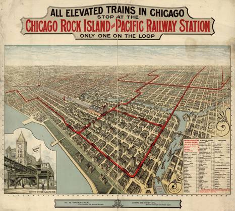
  • MAP: CHICAGO TRAINS, c1897. A map showing the elevated train lines of the Chicago, Rock Island and Pacific Railroad in Chicago, Illinois. Map published by Poole Bros., c1897.  Copyright: xGRANGERx xGRANGERx 0216440

    MAP: CHICAGO TRAINS, c1897. A map showing the elevated train lines of the Chicago, Rock Island and Pacific Railroad in Chicago, Illinois. Map published by Poole Bros., c1897. Copyright: xGRANGERx xGRANGERx 0216440

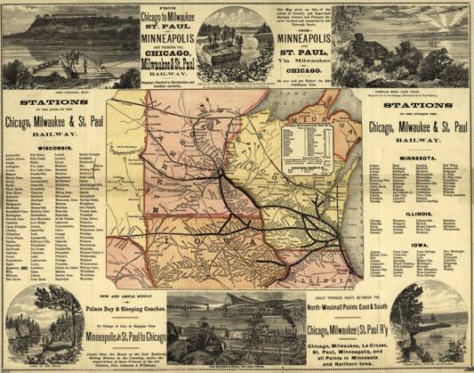
  • MAP: RAILWAY, 1874. A map of the Chicago, Milwaukee, and St. Paul railways, with illustrations. Map by Rand McNally & Co., 1874.  Copyright: xGRANGERx xGRANGERx 0216438

    MAP: RAILWAY, 1874. A map of the Chicago, Milwaukee, and St. Paul railways, with illustrations. Map by Rand McNally & Co., 1874. Copyright: xGRANGERx xGRANGERx 0216438

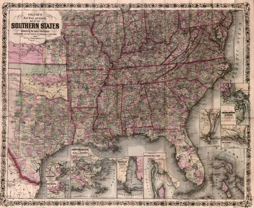
  • MAP: AMERICAN SOUTH, 1864. Colton s Rail Road and County Map of the Southern States Containing the Latest Information. Published by Joseph Hutchins Colton, 1864.  Copyright: xGRANGERx xGRANGERx 0186675

    MAP: AMERICAN SOUTH, 1864. Colton s Rail Road and County Map of the Southern States Containing the Latest Information. Published by Joseph Hutchins Colton, 1864. Copyright: xGRANGERx xGRANGERx 0186675

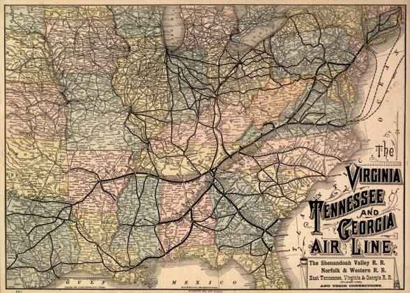
  • MAP: RAILROAD, 1882. The Virginia, Tennessee, and Georgia Air Line; the Shenandoah Valley R.R.; Norfolk & Western R.R.; East Tennessee, Virginia, & Georgia R.R... Map by Rand McNally & Co., 1882.  Copyright: xGRANGERx xGRANGERx 0186217

    MAP: RAILROAD, 1882. The Virginia, Tennessee, and Georgia Air Line; the Shenandoah Valley R.R.; Norfolk & Western R.R.; East Tennessee, Virginia, & Georgia R.R... Map by Rand McNally & Co., 1882. Copyright: xGRANGERx xGRANGERx 0186217

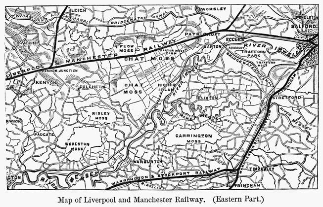
  • ENGLAND: RAILROAD MAP. Map of the Liverpool and Manchester Railway (Eastern Part), 19th century.  Copyright: xGRANGERx xGRANGERx 0080556

    ENGLAND: RAILROAD MAP. Map of the Liverpool and Manchester Railway (Eastern Part), 19th century. Copyright: xGRANGERx xGRANGERx 0080556

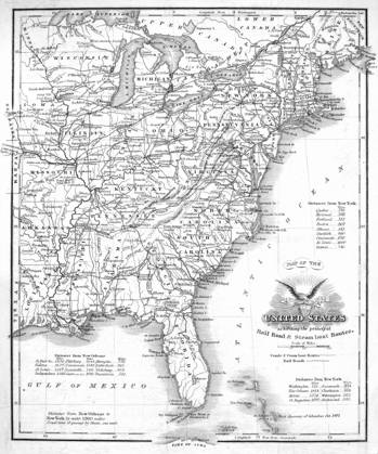
  • RAILROAD & CANAL MAP, 1863. A Railroad and Canal map of the Eastern United States, 1863.  Copyright: xGRANGERx xGRANGERx 0079138

    RAILROAD & CANAL MAP, 1863. A Railroad and Canal map of the Eastern United States, 1863. Copyright: xGRANGERx xGRANGERx 0079138

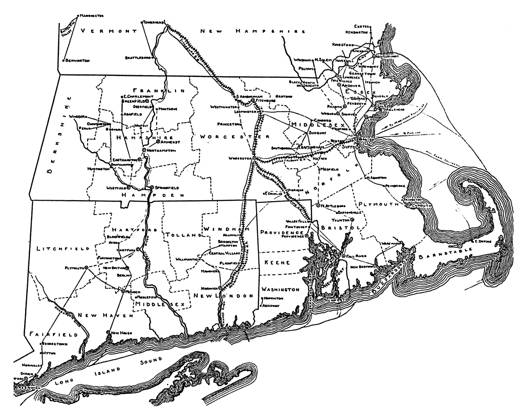
  • UNDERGROUND RAILROAD MAP. Routes of the Underground Railroad through southern New England.  Copyright: xGRANGERx xGRANGERx 0051381

    UNDERGROUND RAILROAD MAP. Routes of the Underground Railroad through southern New England. Copyright: xGRANGERx xGRANGERx 0051381

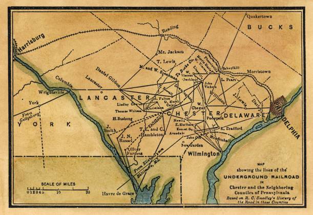
  • UNDERGROUND RAILROAD MAP. Nineteenth-century map showing the lines of the Underground Railroad in part of Pennsylvania, a free state bordering the slave states of Maryland and Delaware.  Copyright: xSarinxImagesx xGRANGERx 0037232

    UNDERGROUND RAILROAD MAP. Nineteenth-century map showing the lines of the Underground Railroad in part of Pennsylvania, a free state bordering the slave states of Maryland and Delaware. Copyright: xSarinxImagesx xGRANGERx 0037232

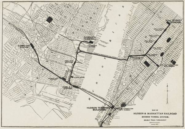
  • RECORD DATE NOT STATED New York Subway Map of the Hudson and Manhattan Railroad subway system in New York, America January 1908  Copyright: Gemini Picture No. 10283379

    RECORD DATE NOT STATED New York Subway Map of the Hudson and Manhattan Railroad subway system in New York, America January 1908 Copyright: Gemini Picture No. 10283379

Kollektionen
Auswahl